
Advanced Airborne Measurement Solutions
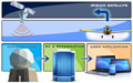

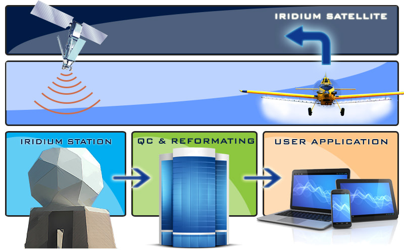
The AvSTAR system is a full-featured solution for remote monitoring of airborne and ground-based vehicles. Mobile assets can be monitored from anywhere with AvSTAR. All that is required is a PC or laptop running a web browser and an Internet connection. Three major components comprise the AvSTAR system: the onboard data management system (ODMS), the data transmission system, and the AvSTAR server.
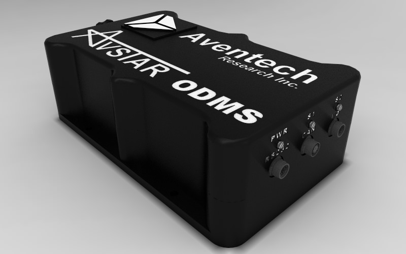
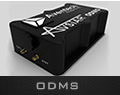
The Onboard Data Management System (ODMS) collects data from a variety of onboard systems such as: GPS, AIMMS-20 (meteorology), laser or radar altimeters, flow controllers, switches, etc. This data can be input utilizing an integrated high-speed Controller Area Network (CAN) interface, four RS-232 serial ports, or ten digital input/output pins. An embedded microprocessor assembles packets and sends them to the data transmission system using an internal modem. If no external GPS device is available, an optional internal WAAS-enabled GPS board allows the ODMS to act as a stand-alone positioning unit.
Data is transmitted to the AvSTAR server by one of two possible options: the Iridium Short Burst Data (SBD) satellite network or cellular data networks. The Iridium network consists of 64 LEO (low earth orbit) satellites in which one satellite will always be in-view of your mobile asset and four other satellites at the same time. Data is relayed between Iridium satellites to the nearest ground station. Data is then sent from the ground station via the Internet to the AvSTAR server. This ensures fast, reliable, error-free point-to-point data transmission from air or ground vehicles, anywhere in the world.
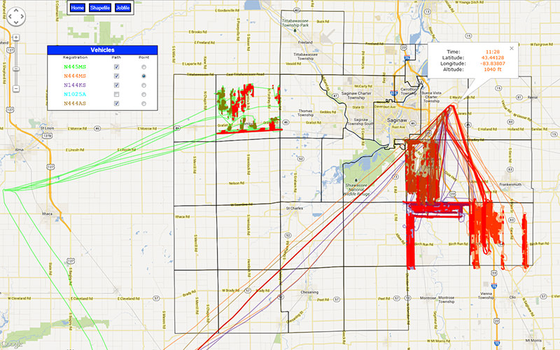
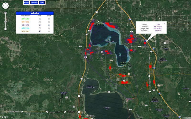
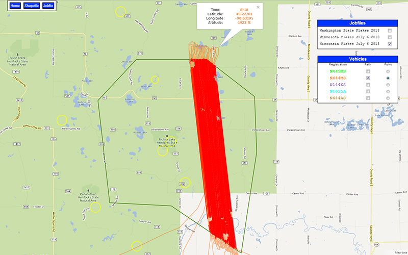
Data from either satellite or cellular systems are forwarded to the AvSTAR server through the Internet. The server then decodes, sorts, and archives this information in a database. Your password-protected data becomes available to you after logging in. It is sorted by aircraft or vehicle registration, operation date, and time. Previous vehicle data can be recalled and displayed, a mission can be replayed, or a mission in progress can be tracked in real-time.
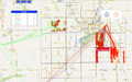
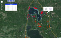
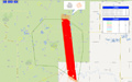
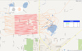
The benefits of AvSTAR are delivered without special software. An Internet connection and standard web-browser application are all you need to view your data. Each flight or ground track can be displayed over one of several possible user-selectable map backgrounds. Currently supported backgrounds include: Google road maps, Google terrain maps and Google satellite imagery. Unique to AvSTAR, user-supplied Shapefiles can be used to generate background map imagery. Integrated pan and zoom controls allow you to generate optimal views of vehicle tracks and the chosen background map. Tracks are colour shaded depending on a switch status from one of the ODMS digital inputs, which can be used to represent spray-boom or fogger on/off status. As a powerful feature of AvSTAR, vehicle tracks can be exported in Shapefile format to permit analysis with any GIS application of your choice.
AIMMS-20  |
AIMMS-20 PMS  |
AIMMS-30  |
ARIM200  |
ARIM310 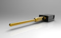 |
ARIM320 |
|
| Pitot-Static | ||||||
| AOA & AOS | ||||||
| Static | ||||||
| Temperature | ||||||
| Humidity | ||||||
| Wind Data* | ||||||
| Acceleration | ||||||
| Attitude | ||||||
| Anti-ice Heater | Optional 150W | Optional 350W | 250W | 200W | 200W | |
| Environmental Heater | 50W | 200W | 50W | 50W | ||
| Pneumatic Purge | ||||||
| Interface | CAN RS-232 RS-485 |
CAN RS-232 RS-485 |
CAN RS-232 RS-485 |
CAN RS-232 RS-485 |
CAN RS-232 RS-485 |
CAN RS-232 RS-485 |
| Optional Touch Display | ||||||
| GPS | ||||||
| USB | Optional add-on | Optional add-on | Built-in | Optional add-on | Optional add-on | Optional add-on |
| Dimensions | 1.5" dia. boom 24" long 9" long pylon |
1.5" dia. boom 45" long |
0.75" dia. boom 13" long 4.5" long pylon |
1.5" dia. boom 24" long |
0.75" dia. boom 4 x 4.5 x 2.25 in. enclosure |
0.75" dia. boom 4 x 4.5 x 2.25 in. enclosure |
| Weight | 3.2kg | 5.5-6.5kg | 1.08kg | 1.9kg | 0.75kg | 0.845kg |
| Surface Finish | Gold anodized/ TiN opt. |
TiN coated & black anodized | Gold anodized/ TiN opt. |
TiN coated/ Anodizing opt. |
TiN coated & black anodized | TiN coated & black anodized |
| Mil-Standard | ||||||
| Availability | In production | In production | Available in March, 2014 | In production | In production | In production |
PS: Pitot-Static | AOA: Angle of Attack | AOS: Angle of Sideslip
* Wind data includes wind speed, wind direction, and vertical wind
Copyright © Aventech Research Inc.